
Mount Roraima
Brazil, Guyana, Venezuela·South America
Mount Roraima is the highest tepui in the Pacaraima mountain chain, straddling the borders of Brazil, Guyana, and Venezuela. Known for its dramatic sheer cliffs and flat summit, it is a unique geological formation that has fostered a high degree of endemic flora and fauna due to its isolation. The mountain's name originates from the Pemon people, meaning "blue-green great," reflecting its natural beauty.
Key Facts
- ›Located at the junction of Brazil, Guyana, and Venezuela, forming the highest point of the Pacaraima chain of tepuis.
- ›Characterized by sheer cliffs ranging from 400 to 1,000 meters (1,300 to 3,300 ft) in height.
- ›The summit is a pseudo-karst surface etched by heavy rainfall, featuring numerous endemic species of plants and animals.
- ›Composed of ancient Proterozoic sandstone formed approximately 1.7 to 2 billion years ago.
- ›First explored by Europeans in 1595 and first climbed by a British expedition in 1884.
- ›A popular destination for hikers, with ascents typically taking three to five days from the Venezuelan side.

Monte Roraima, Tepuy Roraima, Cerro Roraima
Pemon Indigenous Beliefs
- the Name 'Roraima' Originates From the Pemon Language, Meaning 'Blue-Green Great'.
- Considered A Sacred Mountain By the Indigenous Pemon People.
- the Unique Geological Formations and Endemic Life Have Inspired Awe and Exploration.
Walter Raleigh, Robert Hermann Schomburgk, Carl Ferdinand Appun, Charles Barrington Brown, Everard Im Thurn, Harry Perkins, Henry Whiteley
- Monthly Quota of 200 People For Climbing In Canaima National Park.
About Mount Roraima
Mount Roraima is the highest and most prominent of the Pacaraima chain of tepuis, which are distinctive table-top mountains found in South America. This majestic geological formation is uniquely situated at the tripoint border of Brazil, Guyana, and Venezuela, making it a significant landmark in the Guiana Highlands. Its name, derived from the local Pemon indigenous people, translates to 'blue-green great,' reflecting its striking natural beauty.
Geography and Geology
The mountain is characterized by immense, sheer cliffs that rise between 400 to 1,000 meters (1,300 to 3,300 ft). The summit, a vast plateau covering approximately 33–50 square kilometers (13–19 sq mi), features a peculiar pseudo-karst topography shaped by intense rainfall and erosion over millions of years. Geologically, Mount Roraima is composed of ancient Proterozoic sandstone, formed about 1.7 to 2 billion years ago, making it one of the oldest rock formations on Earth. This sandstone sits atop a base of granite and gneiss and is rich in quartz deposits.
Ecology and Endemism
The geographical isolation and unique environmental conditions of Mount Roraima have fostered a remarkable degree of endemism in its flora and fauna. Many species found on and around the mountain are found nowhere else on Earth. The summit supports a variety of ecosystems, including bare rocks, forests, savannas, and swamps, with many endemic carnivorous plants adapted to the nutrient-poor sandstone soils. The diverse fauna includes numerous endemic rodents, birds, and amphibians, though much of its ecology remains to be fully understood due to the challenges of exploration.
Exploration and Access
European exploration of Mount Roraima began in the late 16th century, with notable expeditions in the 19th century by figures like Robert Hermann Schomburgk and Everard im Thurn. The first recorded ascent by a European expedition was in 1884. Despite its formidable cliffs, the southern side of the mountain offers a natural slope that allows for relatively accessible climbing. Mount Roraima is now a popular destination for hikers, with ascents typically requiring three to five days. Access is managed with a monthly quota to preserve its fragile environment, particularly within Canaima National Park.
Source: Wikipedia ↗
Frequently Asked Questions
What is Mount Roraima?
Mount Roraima is the highest of the Pacaraima chain of tepuis, which are table-top mountains or plateaux. It is renowned for its sheer cliffs and unique summit environment, which has led to a high degree of endemic species.
Where is Mount Roraima located?
Mount Roraima is situated at the tripoint border of Brazil, Guyana, and Venezuela, within the Guiana Highlands of South America. The majority of the mountain (85%) lies within Venezuela.
What is the elevation of Mount Roraima?
The highest point of Mount Roraima is 2,810 meters (9,220 ft) above sea level, located in Venezuela. Another high point, at 2,772 meters (9,094 ft), is the highest point in Guyana.
What is the origin of the name Mount Roraima?
The name Mount Roraima is derived from the native Pemon people. 'Roroi' means 'blue-green' and 'ma' means 'great' in the Pemon language.
What are the climbing conditions on Mount Roraima?
The ascent from the Venezuelan side is relatively easy and does not require special equipment or training, making it accessible to hikers. The climb typically takes three to five days, including time to explore the summit.
What is unique about Mount Roraima's ecology?
Due to its geographical isolation and the unique conditions on its summit, Mount Roraima is home to a significant number of endemic flora and fauna, many of which are still being discovered and studied.
Related Sacred Mountains
Aconcagua
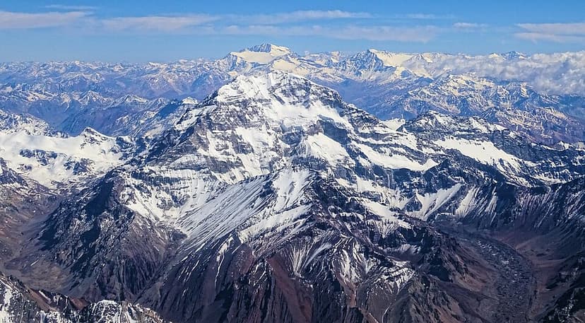
Aconcagua is the highest mountain in the Americas, located in Mendoza Province, Argentina. It is also the highest peak outside of Asia and the second-most topographically prominent peak globally. Formed by tectonic activity, it was once an active stratovolcano and is now a significant challenge for mountaineers due to its extreme altitude, despite its technically straightforward normal route.

Machu Picchu
Machu Picchu is a 15th-century Inca citadel situated on a mountain ridge in southern Peru, standing as a significant symbol of the Inca civilization. Believed to have been an estate for Emperor Pachacuti, the site was likely abandoned around the time of the Spanish conquest, with modern dating placing its occupation between the early 15th and early 16th centuries. It is renowned for its classical Inca architecture, including finely crafted dry-stone walls and notable structures like the Temple of the Sun.
Nevado Ojos del Salado
Nevado Ojos del Salado is a dormant complex volcano located in the Andes on the border of Argentina and Chile. It holds the distinction of being the highest volcano on Earth and the highest peak in Chile. The mountain is significant for its extremely dry conditions, which limit ice cover, yet it hosts the world's highest lake within its summit crater. Its volcanic activity dates back to the Pleistocene and Holocene, with the last eruption occurring around 750 CE.