
Black Hills
The Black Hills, known to the Lakota as Pahá Sápa, are a sacred mountain range rising from the Great Plains of North America. They hold deep spiritual significance for Indigenous American tribes, particularly the Lakota, who consider the entire region "the heart of everything that is." Despite being illegally seized by the U.S. government after a gold rush, the Black Hills remain a vital cultural and spiritual center, with ongoing efforts to reclaim their ancestral lands.
Key Facts
- ›The Black Hills are an outlying subrange of the Rocky Mountains, located in western South Dakota and eastern Wyoming.
- ›The Lakota name for the range is Pahá Sápa, meaning 'Black Hills,' due to their dark appearance from afar.
- ›The mountains formed from an upwarping of ancient rock, shaped by stream erosion into their current topography.
- ›Indigenous tribes have inhabited the Black Hills for at least 11,500 years, with the Lakota considering it a sacred site.
- ›A gold rush in 1874 led to the illegal seizure of the Black Hills by the U.S. government and the forced relocation of the Lakota.
- ›Black Elk Peak, at 7,242 feet (2,207 M), is the range's highest summit.

Pahá SáPa
Lakota Spirituality, Indigenous American Spirituality
- Central To Lakota Culture and Identity
- Considered Sacred Ground By Various Indigenous American Tribes
- Site of Historical Conflicts Over Land and Resources
- Symbol of Indigenous Resistance and Ongoing Land Claims
Black Elk, George Armstrong Custer, Valentine Mcgillycuddy
About Black Hills
Overview
The Black Hills, known in the Lakota language as Pahá Sápa, are a sacred mountain subrange of the Rocky Mountains that dramatically rise from the Great Plains of North America. Located primarily in western South Dakota and extending into eastern Wyoming, they are characterized by their dark, forested appearance from a distance, giving rise to their name.
Significance and Indigenous History
The Black Hills hold profound spiritual and cultural importance for a multitude of Indigenous American tribes, most notably the Lakota, who consider the entire region to be sacred ground, referring to it as "wamakaognaka e'cante," meaning "the heart of everything that is." Archaeological evidence indicates a human presence in the area dating back as far as 11,500 BC. Throughout centuries, various Indigenous groups, including the Ponca, Arikara, Mandan, Kiowa, Plains Apache, Shoshone, Cheyenne, Arapaho, and Lakota Sioux, have inhabited or utilized the Black Hills.
Conflict and Land Disputes
Historically, the Black Hills were recognized as the exclusive territory of the Lakota under treaties such as the First Treaty of Fort Laramie in 1851 and the Second Treaty of Fort Laramie in 1868, which promised to protect the land from non-indigenous settlement "forever." However, the discovery of gold in 1874 by George Armstrong Custer's expedition sparked a massive gold rush. This led to the U.S. government's illegal seizure of the Black Hills and the forced relocation of the Lakota following the Great Sioux War of 1876. Despite the U.S. Supreme Court ruling in 1980 that the seizure was illegal, ordering financial compensation, the Lakota have refused the settlement, continuing to seek the return of their ancestral lands.
Geology and Geography
The geology of the Black Hills is complex, shaped by a Tertiary mountain-building episode that resulted in uplift and volcanic activity. The core of the range is composed of Precambrian granite, pegmatite, and metamorphic rocks, dating back as far as 1.8 billion years, surrounded by rings of Paleozoic, Mesozoic, and Cenozoic sedimentary rocks. This geological structure forms an oval dome, with different rock types dipping away from the center. The highest point in the range is Black Elk Peak, reaching 7,242 feet (2,207 meters), first documented as ascended by a European American in 1875.
Modern Era and Tourism
In the modern era, the economy of the Black Hills has shifted from natural resources to tourism and hospitality. The region is a popular destination, featuring attractions such as Mount Rushmore National Memorial, Wind Cave National Park, Jewel Cave National Monument, Custer State Park, and the Sturgis Motorcycle Rally. The Black Hills National Forest encompasses much of the range, offering recreational opportunities. The area continues to be a focal point for Indigenous cultural heritage and ongoing efforts to address historical injustices.
Source: Wikipedia ↗
Frequently Asked Questions
What is the significance of the Black Hills to Indigenous peoples?
The Black Hills are considered sacred ground by various Indigenous American tribes, especially the Lakota, who refer to the entire region as 'the heart of everything that is.' They have been inhabited by Indigenous peoples for millennia and are central to their culture and spiritual beliefs.
What led to the U.S. government's seizure of the Black Hills?
The discovery of gold by George Armstrong Custer's expedition in 1874 triggered a gold rush, leading to widespread American settlement. Despite the Fort Laramie Treaty of 1868, which exempted the Black Hills from non-indigenous settlement, the U.S. government forcibly seized the land after the Great Sioux War of 1876.
What is the highest point in the Black Hills?
The highest summit in the Black Hills is Black Elk Peak, which reaches an elevation of 7,242 feet (2,207 meters) above sea level. It was first ascended by a European American, Valentine McGillycuddy, in 1875.
What is the current status of the Black Hills dispute between the Lakota and the U.S. government?
In 1980, the Supreme Court ruled that the Black Hills were illegally seized and ordered remuneration. However, the Lakota refused the financial settlement, seeking the return of the land itself. The funds remain in an account, accruing interest, while the Lakota continue their efforts to reclaim the Black Hills.
What are the main geological features of the Black Hills?
The Black Hills exhibit a complex geology characterized by an uplifted dome. This structure features a Precambrian granite core surrounded by concentric rings of metamorphic and various sedimentary rock layers from Paleozoic, Mesozoic, and Cenozoic eras, creating a 'target' like stratigraphy.
Related Sacred Mountains
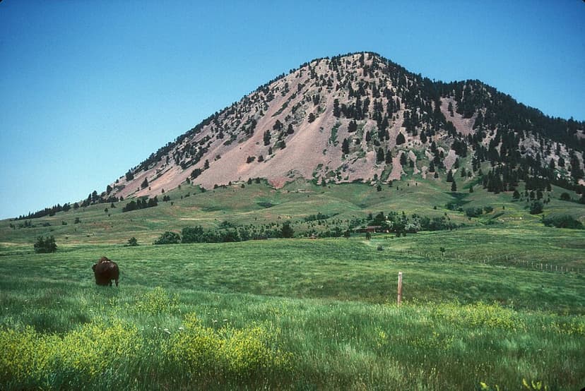
Bear Butte
Bear Butte, known to the Lakota as Matȟó Pahá and to the Cheyenne as Noahȧ-vose, is a significant geological laccolith and sacred site for Plains Indian tribes. It holds profound religious importance, particularly for the Cheyenne, who believe the Great Spirit imparted essential knowledge to the prophet Sweet Medicine here. The mountain is a place of prayer, meditation, and pilgrimage, where visitors leave offerings and participate in ceremonies.

Devils Tower
Devils Tower, also known as Matȟó Thípila or Bear Lodge, is a prominent laccolithic butte located in northeastern Wyoming. Renowned for its dramatic geological formation and deep cultural significance to Native American tribes, it was designated as the United States' first national monument in 1906. The tower holds profound spiritual importance for various Plains tribes, who share ancient legends explaining its origins.
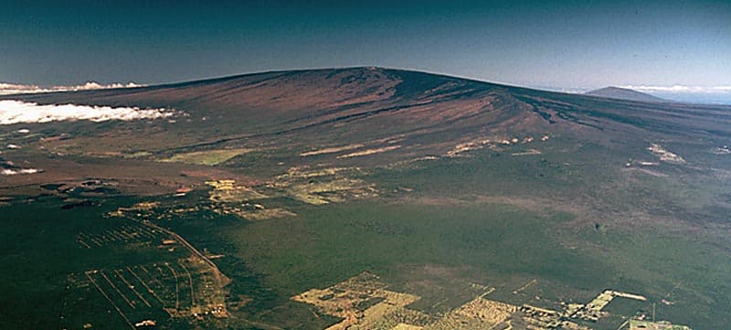
Mauna Loa
Mauna Loa, meaning 'Long Mountain' in Hawaiian, is one of the five volcanoes forming the Island of Hawaii and is recognized as Earth's largest active volcano by mass and volume. Ancient Hawaiians held deep spiritual connections to this massive shield volcano, admiring its sheer scale, though many of these traditions are less practiced today. Its geological history is marked by continuous eruptions for at least 700,000 years, driven by the Hawaii hotspot, and it poses significant hazards due to its potential to destroy populated areas.